
Trace Harlingen Street Directory Records
For a street-by-street question, begin with the location rather than a surname. Cameron Appraisal District, known as CAD, connects a known address to an account number, parcel context, legal description, and the current appraisal owner field. The Cameron County Clerk then connects names and legal descriptions to deeds, plats, liens, releases, and other recorded instruments. That sequence makes a Harlingen street directory useful for a careful property trail, not a claim about every person at every door.
- Normalize the house number, direction, suffix, and present street spelling. Keep a former street name, rural-route label, or postal alias in the notes if an older source uses one.
- Use the Cameron Appraisal District property-search route or its public portal to find the situs address, account or property ID, and legal description.
- Open the map view to see the parcel geometry and record the account for the parcel being researched. A nearby map label is context, not title evidence.
- Search the Cameron County Official Records Search by party name, subdivision, legal description, or recorded-date range. Match the instrument to the same tract before treating it as part of the chain.
- Use the historic index, local newspaper archive, and city-directory volumes for dated household context. A name listed at an address is evidence for that cited edition, not continuous occupancy.
For registration status, the official VoteTexas lookup is a person-matching service using name, county, date of birth, and ZIP or an alternate identifier. It is not a browseable street roster. Cameron County voter records also protect some fields and protected voters' addresses.
Harlingen Street Directory Address Layers
A Harlingen address may have four useful forms. USPS supplies a delivery format. The city code supplies the official public-road name. CAD uses a situs address for parcel and appraisal context. The County Clerk's deed can instead identify a lot, block, subdivision, survey, abstract, or other legal description. Keep each form separate. A ZIP is a delivery boundary, and the CAD map point can sit near an outlying community or city line without deciding municipal jurisdiction.
| Postal address | Formats mail and ties a delivery point to a ZIP. It does not establish a city-limit boundary. |
|---|---|
| Official street name | The city street-naming ordinance's current public-road name, useful for municipal requests and spelling checks. |
| Situs address | The physical parcel address in CAD appraisal and map context. CAD says it does not issue physical addresses. |
| Legal description | The lot, block, subdivision, survey, or tract language that bridges an address to a deed or plat. |
The distinction matters in Harlingen because 78550 also carries postal aliases such as Primera and Stuart Place, while city jurisdiction can depend on annexation history. For rural, Primera, and Combes address letters, CAD directs inquiries to the Cameron County Emergency Communication District. An address mismatch needs a source-by-source check, not a forced match.
Note: Preserve the source date with each form of the address because parcel, postal, and municipal records can change on different schedules.
Harlingen Street Directory CAD Fields
The CAD landing page routes to a script-driven public portal, so its visible search concepts are more dependable than promises about every live filter. Use a narrow search first. An account or property ID is the best handoff from a map selection to the property card. If a street number fails, try the owner name, the legal description, subdivision terms, or a carefully normalized situs address.
| CAD search field | Format | Use in a street search |
|---|---|---|
| Owner name | Optional text | Finds the appraisal owner index; use surname, initials, and entity variants where relevant. |
| Property or situs address | Optional text | Connects a known physical address to a parcel record. |
| Account or property ID | Optional text | Provides the most direct bridge from a map parcel to its record. |
| Legal description or subdivision | Text or available selection | Helps when street numbering is inconsistent or an instrument lacks a modern address. |
| Map Search / Public Portal | Linked map mode | Supplies parcel geometry and the handoff to property context; live controls can change. |
CAD reports appraisal information. It does not collect taxes, provide a survey, supply deeds or plats, issue permits, or change ownership without a recorded deed reference. Those limits keep the street directory chain honest: use CAD for the parcel lead, the clerk for recorded instruments, the Tax Office for payment questions, and the city for permit or code records.
The Cameron CAD public portal is shown below as the parcel-search route linked by the appraisal district.
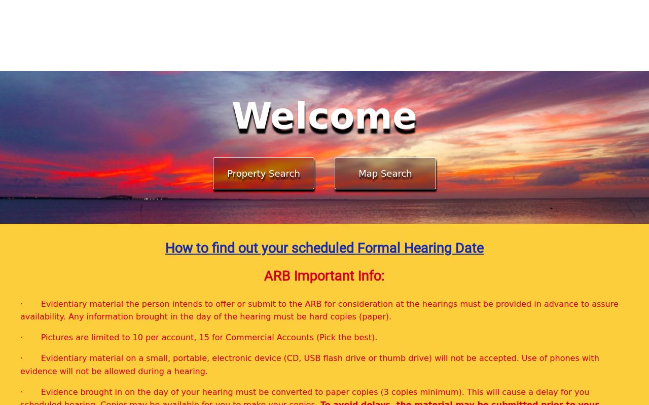
Use the displayed portal as a starting point for one parcel at a time, then save the account or legal-description lead before moving to the recorded index.
Harlingen Street Directory Deed Trails
The current clerk portal has Quick Search and Advanced Search. Its search term can look for a grantor or grantee, subdivision, document type, or document number. Recorded-date fields narrow the result set. The portal also distinguishes index-only searching from index-and-full-text OCR. Two or more words are treated individually in index-only mode, while an OCR query can search a phrase in document text. That difference can prevent a weak multiword result from becoming a false address match.
The safest order is current parcel, current owner or legal description, likely deed, seller named in that deed, and then the prior acquisition. A grantor is the person transferring an interest; a grantee is the person receiving it. Verify the lot, block, subdivision, tract, and recording sequence at every step. A deed of trust records a security interest and is not, by itself, a sale.
- Parcel
- A mapped unit of land tied to a CAD account or property record. Its boundary is spatial evidence, not a survey.
- Situs address
- The physical location label CAD uses for the parcel. It can differ from the owner's mailing address.
- Plat
- A recorded map or plan that can establish lots, blocks, subdivision names, and boundary references.
- Criss-cross directory
- A street-order section of some historical directories, useful for finding listings by address rather than surname.
When the current search is too recent, the Cameron historic index supplies Type, Year, Parties, Last Name, First Name, and Book/Volume/Page routes. It states that historic deed index books cover 1830–1968 and that 1830–1957 entries link to referenced documents. The coverage statement is a starting point, not a guarantee that every image is present.
The Official Records Search is the documented current index route.
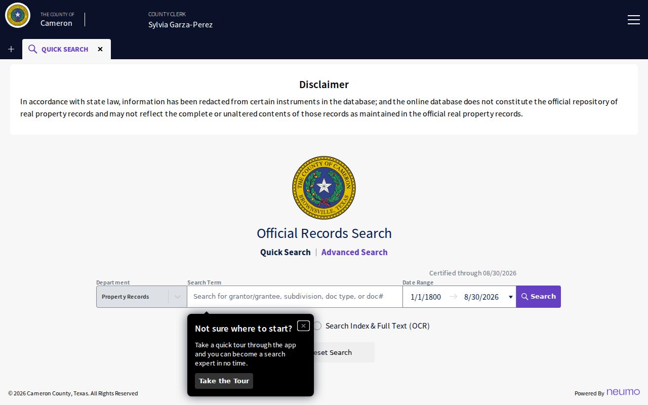
The date controls and index/OCR choice shown here are useful for narrowing an instrument search before requesting an image or certified copy from the clerk.
Note: Match the legal description and recording sequence before connecting a named party to the specific Harlingen parcel.
Harlingen Street Directory Record Coverage
Address-keyed sources answer different parts of a Harlingen street question. The property card can identify an appraisal owner and parcel context. A deed ties an instrument to an interest in land. A plat can explain the lot and subdivision. A city permit can date work at a site. None should be relabeled as a complete list of present household members. Use the strongest source for the narrow fact being checked.
| Address-keyed record | Custodian | What it can establish | Access route |
|---|---|---|---|
| Appraisal parcel record | Cameron Appraisal District | Owner field, situs and mailing data, account, legal description, appraisal context, and map link | Property search and public portal |
| Parcel map | Cameron CAD | Parcel polygon, adjacent context, map ID, and property-record handoff | CAD Map Search |
| Recorded deed, plat, lien, or release | Cameron County Clerk | Parties, document type, recorded date, legal description, instrument or book/page | Current portal, historic index, or clerk copy request |
| Permit or inspection | City of Harlingen | Published site, project, inspection, and work-history information where available | Click2Gov Building Permits; ask the custodian for a dated record if absent |
| Code-enforcement matter | City of Harlingen | Address-keyed notice or responsible-party history where public | Code Enforcement, 956-216-5200; public search fields were not located |
For a clerk copy, identify the instrument or book/page first. The clerk says it does not search records by phone, fax, or email. A plain deed copy starts at $1 per page, and certification adds $5; its FAQ also states that mailed documents generally take 5–7 business days when a typed or printed return name and address are supplied. The Harlingen County Clerk branch is at 3302 W. Wilson Road and is open Monday through Friday, 8:00 a.m. to 4:30 p.m.
Harlingen Street Directory Permit Leads
The City's Click2Gov route says citizens and contractors can complete common permit steps, schedule inspections, and view inspection results. It can help date construction, additions, demolition, or an inspection trail tied to a site. The inspected public route did not expose every search field or the start year of its archive. Treat a missing web result as a request-routing issue, not proof that no permit was issued.
Planning and Zoning, Code Enforcement, Building Permits, and Health have separate city-service contacts. The city services sheet lists building permits at 956-216-5160, planning at 956-216-5101, and code enforcement at 956-216-5200. A written Texas Public Information Act request should identify an existing address, date range, permit number, or case number instead of asking an office to create a street-by-street report.
Note: The public Click2Gov page did not disclose complete historical coverage, so confirm the office's search scope before relying on an absent result.
Harlingen Street Directory History Clues
For a historical street question, pair a directory entry with a map and a dated news item. The June 1919 Harlingen Sanborn map has four public-domain sheets. It can show street layout, building footprint, railroad adjacency, named businesses, and fire-risk construction. It does not identify current ownership or current occupants. State the sheet date whenever using it beside a modern CAD map.
The Harlingen Public Library newspaper archive offers page-text searching, multiple terms, an AND connector, people/place/event searching, and city, title, and date controls. Search the current and historic street spelling with a cross street. Inspect the scan because OCR can misread house numbers, accents, hyphens, and surnames. This approach can reconstruct a street's earlier use without publishing a current private address list.
The historical directory shelf is covered in more depth by the Harlingen city directories collection. For this street directory, use a reverse section only as a dated address lead and keep the edition, page, and publisher with the result.
Harlingen Street Directory Boundaries
Street records can cross city, county, and postal boundaries. The Harlingen charter traces an original 1927 charter, and the Planning and Zoning annexation map dated August 28, 2023 records annexations and disannexations across many decades. A present mailing label may therefore point to an outlying community while the responsible office for a permit, code issue, emergency address, or city service is determined by the parcel's actual jurisdiction.
The city street-naming ordinance provides another useful local check. It requires the current official street name for a rename application and uses the CAD tax-roll concept in its definition of property owner. That phrase means the responsible party in the appraisal record for the procedure. It does not establish who resides at the location. Search an earlier name or abbreviation in historic sources, but use the current official name when contacting a live municipal custodian.
Note: A Harlingen postal label, parcel location, and municipal-service boundary can differ, so record the authority behind each conclusion.
Harlingen Street Directory Limits
A street directory can document a parcel, a recorded interest, a historic directory listing, or a public permit trail. It cannot turn those sources into a reliable roll of everyone who lives at an address. CAD warns that its owner field and situs context are not title proof or an occupancy record. Mailing addresses may belong to a tax representative or post-office box. Historic directories can omit people, use initials, and reflect the collection period rather than the cover year.
Texas protects motor-vehicle personal information under federal law, and utility customer data is not an ordinary public Harlingen lookup. Voter information has separate confidentiality rules, including protected-address and Address Confidentiality Program safeguards. Treat a missing address as a possible safety boundary rather than a puzzle to defeat.
Lawful use. Use address records for a lawful, narrow purpose such as family history, property research, or confirming a public record. Texas law prohibits stalking and harassment; do not use a street search to target, intimidate, or harm anyone.
Harlingen Street Directory Fallbacks
When an online search stops, follow the record's custody. The County Clerk's current portal is the first instrument index. Kofile is the older book-and-volume route. TSLAC identifies Cameron County microfilm at UTRGV, where material can be consulted through the depository or requested through interlibrary loan. Certified copies still come from the County Clerk or District Clerk. The 1854 fire destroyed deed-record volumes C and D for August 14, 1850 through February 6, 1851, so that interval requires later recitations, indexes, probate, tax rolls, plats, newspapers, or archival research.
A good request names the address, legal description, document or book/page, and date range already found. For Texas Public Information Act requests, seek existing records from the officer who holds them. Cameron CAD's open-records guidance explains that a request should describe the record sought and that copy or labor charges may apply. Keeping the parcel account and source date makes the fallback chain far more precise.